Seeing Satellites Overhead
For a while I’ve wanted to take a series of full-sky images to try and see all the satellites going overhead. Usually this means either making a short video or a star trail image, but in most cases the star trails mask the satellite activity. Because of this I started writing some software to try and remove stars from images, leaving only streaks from airplanes and satellites to be more visible. I’ve had some moderate success and I’ve posted the software for others to play with here.
After a couple days a cloudy weather I finally got a perfectly clear and moonless night to set up my all sky camera for 90 minutes. One of my main worries was that most satellites are so dim that my ZWO ASI290MC all sky camera wouldn’t be able to pick them up. After all, I’m in a Bortle 6-7 region, I have terrible light pollution levels.

If I set the camera to a long exposure of 30 seconds or more I would see a lot of stars, but the dim light from a satellite would be divided among many pixels as it traveled across the sky, each one possibly not enough to make it visible in an image. Also a long exposure would mean that light pollution would force me to lower my sensitivity and I would almost definitely not catch any dim satellites. What I really want is the shortest exposure possible so that I can have all the dim light from a satellite being put into as few pixels as possible, but also limit exposure from light pollution.
This short exposure produces the issue of satellites no longer looking like noticeable streaks, but like all other stars in the sky. To counteract this I used StarStax to make 1 minute star trail images from all my short exposure shots, this way the satellites turned back into streaks but the stars stayed pretty much like pin pricks without changing my exposure settings.
I ended up going with 4 second exposures with my ZWO ASI290MC camera gain set between 300 and 375, increasing the gain as the sky got darker. In the video below each frame is one of my 1 minute exposures, can you spot the satellites?
When all the frames are combined I get a satisfying star trail image. We can easily find north, see a few satellites and an airplane, but it’s not quite what I’m going for. Many of the smaller satellites get lost in the chaos of this image.

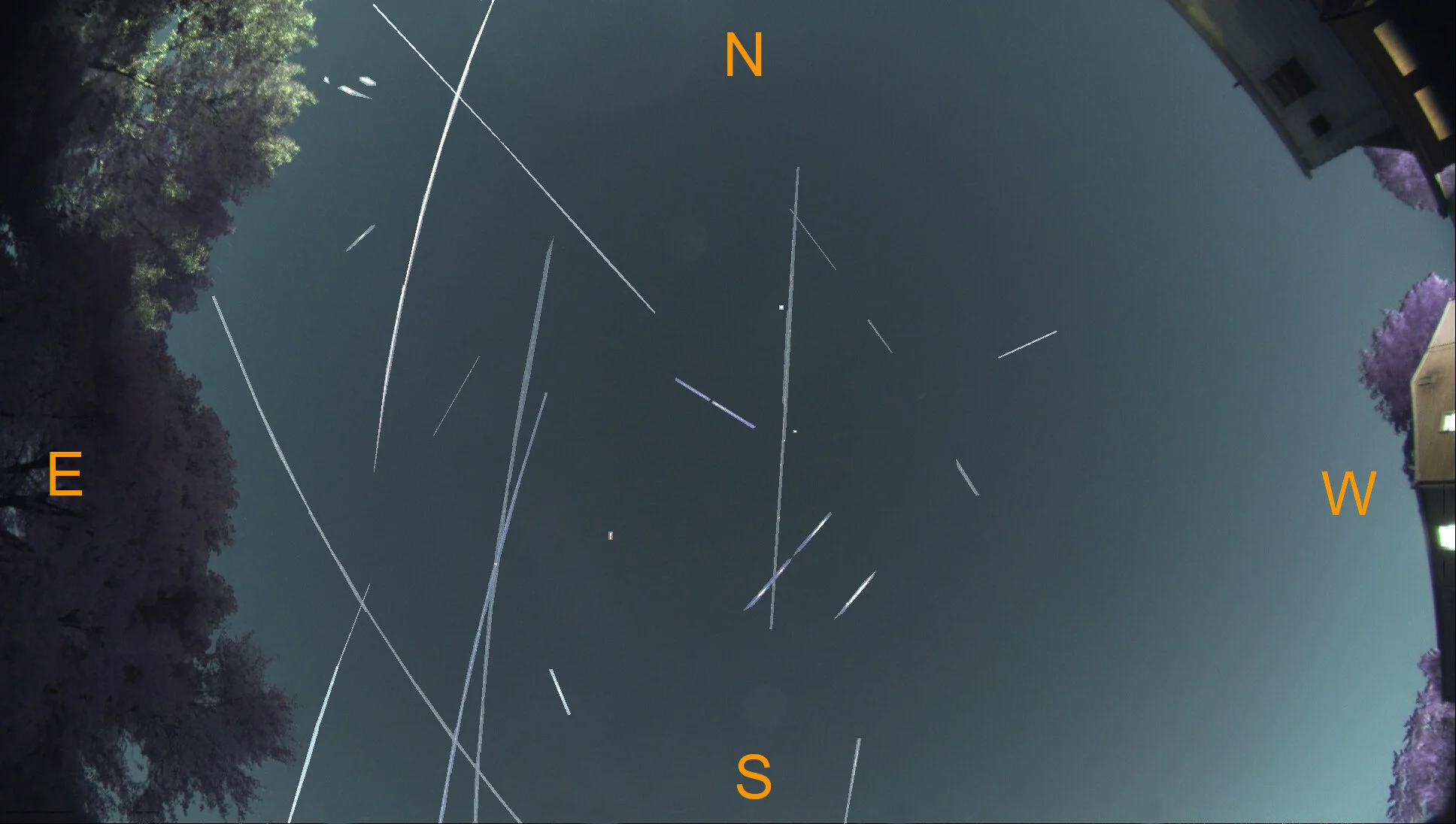
Using the 1-minute exposure images I need to remove the stars and attempt to isolate the satellites. The software I wrote worked very well removing the stars, though some slight touch-ups were needed manually to make the image presentation quality. I created a blank image of just the satellites, and an all-sky frame with all stars removed, then I combined those two images in StarStax.
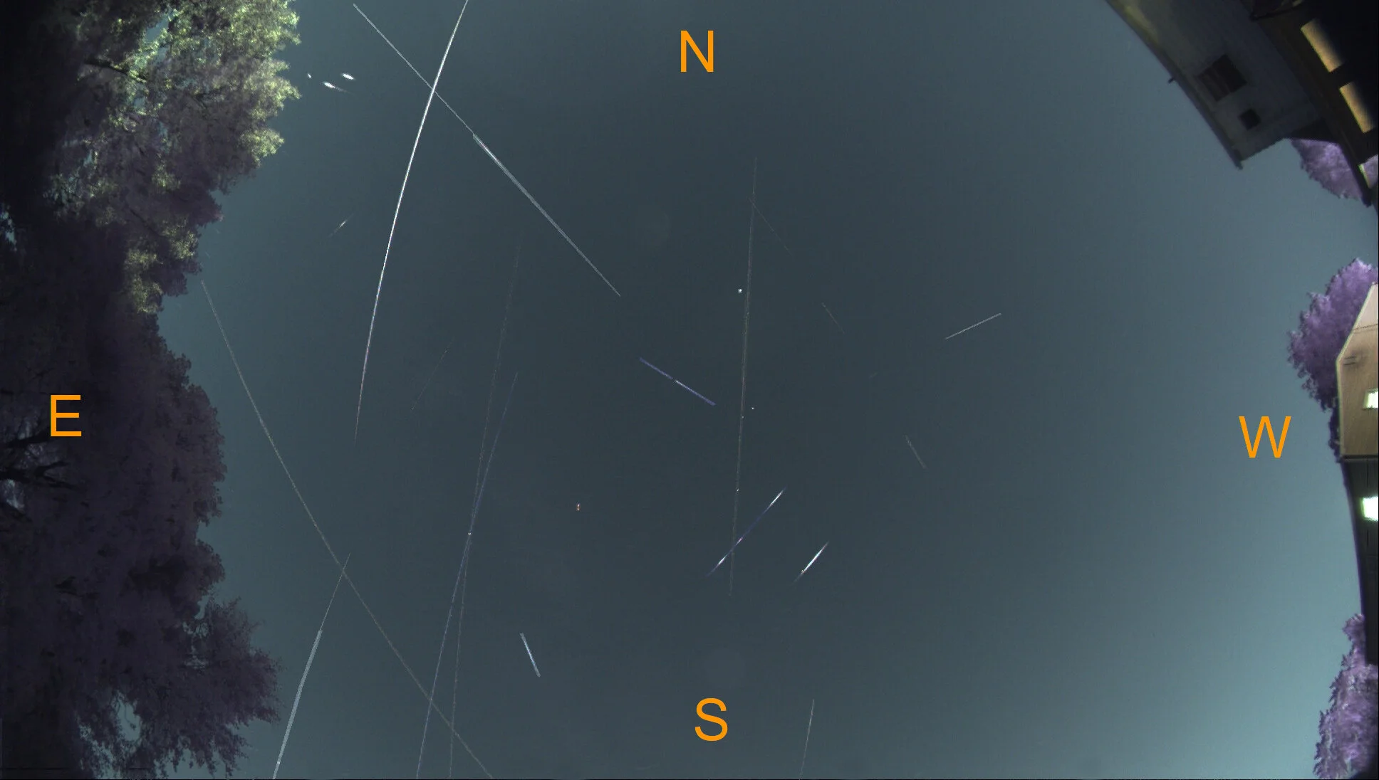
These are the exact brightness levels that my camera saw, I was limited to around magnitude 3 and brighter. There are some long streaks, some that obviously glinted off the sun and were only visible for an instant, but in all there was a lot of activity in those 90 minutes! We can increase the brightness of the satellites to better see all the activity and really make them stand out.
I’ve done my best to identify each satellite, but I wasn’t able to label all of them. The dim satellites that only briefly glinted in the sunlight were hardest to identify. It seems like the majority of
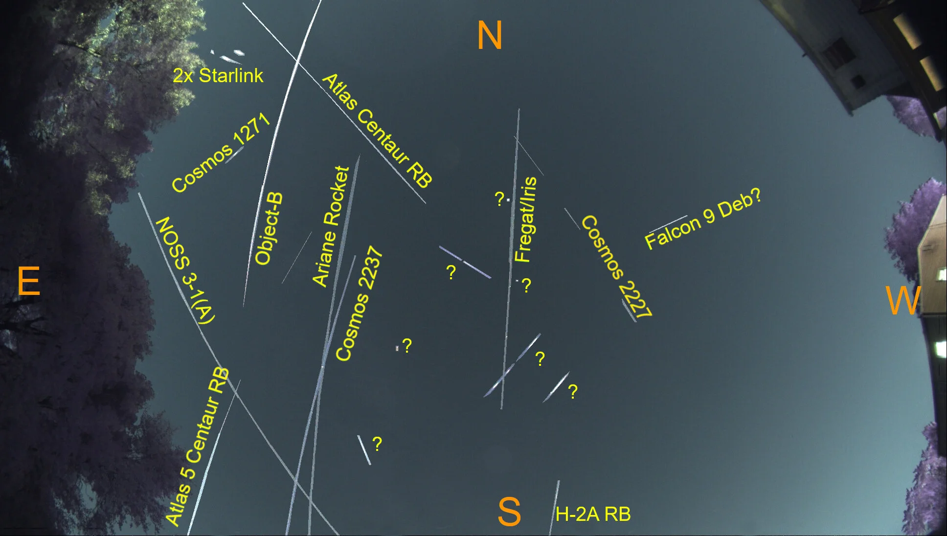
I’m actually a bit surprised how much activity I picked up, and all without an ISS pass! It seems that most are rocket parts, RB usually stands for “rocket body” in these identifications. Also the Fregat/Iris satellite is Russian technology demonstrator consisting of a fregate upper stage attached to some inflated pressurized structure.
This image has been a goal for a while, and I’m happy the weather and moon finally played along nicely. I’m pleasantly surprised how many satellites I was able to catch with my camera in such a light polluted region, one day I’ll have to try this again in a really dark sky location!